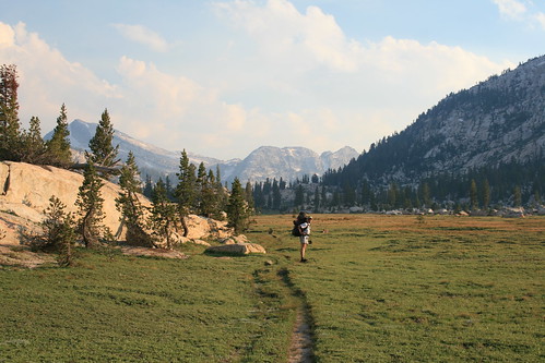
Kerrick Meadows inside Yosemite National Park.
I never knew about the Hoover Wilderness until Romy found a random topo map a few days ago at REI and decided we had to plan a backpacking trip to check it out. Its funny that we never thought of it before, since we've been around the area so many times (its just west of Bridgeport and the Buckeye Hot Springs). Well, we finally made a trip. Romy was kind of in charge of planning it, and he had a good idea about trying to do a thru-hike instead of a loop. It turns out that Marcel & Nicole were also planning a hiking trip for the coming weekend, and they wanted to go to Yosemite, so we asked them if they wanted to hike in the Hoover Wilderness instead (close enough). We would start at one end of the trail, and leave our car there. Nicole & Marcel would start at the opposite end, leaving their car there, and we would pass by each other somewhere in the middle. That way we had a car at each end and didn't have to loop back. We could just do one long thru-hike, never having to repeat the same scenery or terrain.
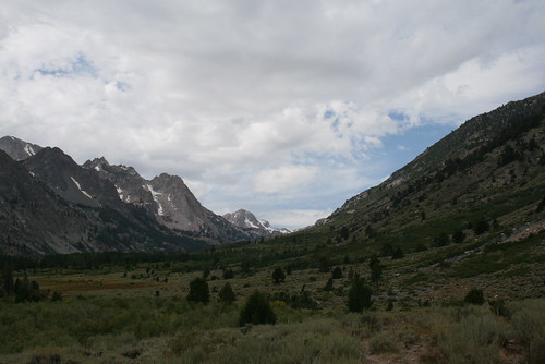
The view as we hiked up-valley along Buckeye Creek.
We started out Saturday morning after getting our hiking/camping permit from the ranger station in Bridgeport off of Hwy 395. You need one to camp in the Hoover Wilderness. We had to tell them where we were planning on hiking, and give them a quick itinerary. We planned on starting at the Buckeye Campground Trailhead, hike up the valley following Buckeye Creek, and then go south through part of Yosemite towards Peeler Lake. Then we would hike out via the Robinson Creek Trail, past Barney Lake, and out at Mono Village. The whole hike was about 25 miles long, and split up between two days was not bad.
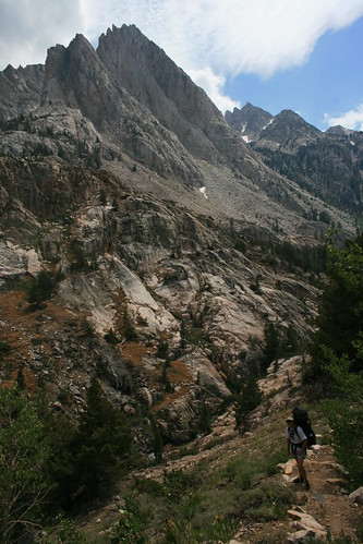
Hiking past gigantic mountains on either side of the Buckeye Creek, nearing Buckeye Forks.
We started out strong at the Buckeye Trailhead. It was hot and dry and sage brush was growing all around us, giving the air a nice smell to it. But it wasn't long before it turned into a muddy, marshy cow pasture! We quickly lost the trail, but we were confined to a pretty narrow valley, and we knew according to the topo map that we were to stay hiking up the valley. The cows were very curious, and some even ran towards us to get a better look. This part of the Hoover Wilderness is the least hiked, and it was pretty obvious because the trail was not maintained at all. At first we tried avoiding getting out feet muddy, but after a while we couldn't do it any longer. Romy almost lost his shoe in some ankle deep mud! But luckily, he pulled it out after a hard fight, complete with the funniest suction sound as his foot came out of the mud, happily with his shoe still on! We joked that we had "feet of mud." Every stream we had to cross we made sure to wash our sandals and legs clean. There were a lot of "dissolved" cow pies in the mud.
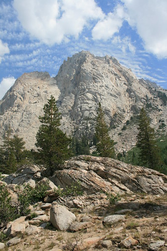
Cool clouds in the sky above huge granite peaks.
Eventually we got out of the mud and back on solid ground. Soon we actually entered the Hoover Wilderness, and the cows were no more. We started climbing a little more steeply, and began getting deeper into the mountains. The granite peaks rose high above up on both sides. The sage brush began to disappear, and we hiked through stunted aspen trees, and large pines. Soon we got right up next to Buckeye Creek, which was so crystal clear! We stopped to have a lunch break by the creek around 2pm after hiking about 8 miles. Our goal was to do at least 11 miles that day. After lunch we kept hiking, and soon we got to Buckeye Forks, where the trail splits in two. There was a small cabin, or shelter thing that was in disrepair, but okay I guess if you were stuck in a storm or something. Also, there were soooo many mosquitoes all of a sudden. I kind of was not expecting them so high up in the mountains.
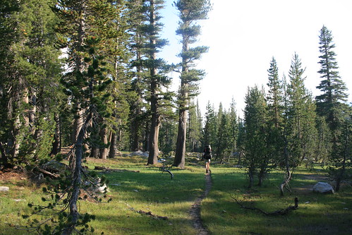
We reached the Yosemite Park boundary and that means we're up and over Buckeye Pass!
We took the left fork that went south, towards Buckeye Pass, which was 9,000+ feet. We had plans on camping somewhere just before the pass. I was starting to get pretty tired as we hiked towards the pass, but after the trail forked, we only had one or two miles left before we decided it would be okay to stop for the day. But Romy had this crazy amount of energy, which he thinks is due to recently starting the gluten-free diet, and he wanted to hike all the way to Peeler Lake, which was still 4 more miles! I wasn't sure, since my feet were getting pretty tired, but after a few breaks, I was feeling okay to keep going.
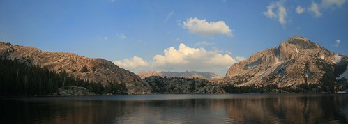
A panoramic picture of Peeler Lake, where we camped Saturday night.
The trail towards Buckeye Pass was very flat, and was filled with nice meadows and sparse pine forests that had a lot of stunted trees, from the altitude. It made me feel like I was walking around through a different land, where everything was miniature or something (except the huge mountains surrounding us). It didn't really look like we were hiking towards a mountain pass at all. We were walking through meadows of wildflowers and a meandering creek. Before we knew it, we had reached the summit, which also meant we were entering Yosemite National Park, which the trail crossed through for about a mile or so, before heading back into the Hoover Wilderness. We couldn't camp in Yosemite because we didn't have a bear canister for our food, so we were forced to move on to Peeler Lake. The Yosemite part of the trail was really beautiful, especially Kerrick Meadow. We stopped there for a break before finding a camping spot next to Peeler Lake.
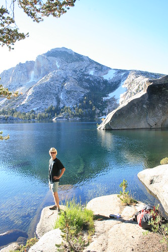
Romy standing at Peeler Lake in the morning.
We didn't see any other human beings the entire 15 mile hike from Buckeye to Peeler Lake, but as we got to Peeler Lake, we saw about 5 people! I guess its a popular spot! Some people were illegally camped too close to the water (you need to stay 100 feet away at least) which was kind of annoying. They have that rule on purpose, so that when you look at the lake, you don't also have to look at tents and stuff. We found a nice spot on the granite outcrops surrounding the lake, south of the trail. Unfortunately there were mosquitoes here too, so we quickly built the tent and got inside, away from the bugs. We didn't put the rain fly up, just the mesh part, so that we could see through the mesh and look at the sunset cast different colors on the mountains and clouds. Then at night, we were able to see the sky really clearly, and we saw the milky way.
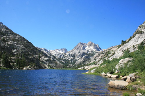
We spent an hour or so at Barney Lake, where we met Nicole and Marcel.
The next morning we woke up when the sun hit us and it started getting hot. It was about 7:30am. We only had 8 easy miles to go to Mono Village. After breakfast, we packed everything up and hit the trail. It was all downhill from here. As I started hiking, I noticed that both my achilles tendons were hurting when I hiked. I figured out a way to walk so that they didn't hurt. I basically had to limp so that my feet would stay flat. I had to take lots of breaks, and it made the last 8 miles seem really long! But at least they were downhill, and most of the route was shaded out of the sun.
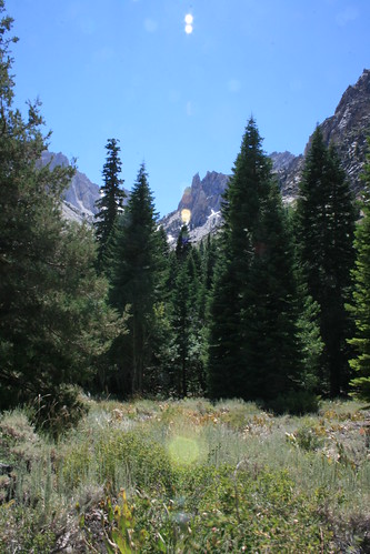
Sage, pine trees, wildflowers, and granite peaks filled our weekend.
When we finally got to Barney Lake, we were expecting to meet Nicole and Marcel, who started their hike that morning in the opposite direction. We got there around 11am, but they weren't there. So we decided to wait for them since it was such a nice spot to sit and relax. After 40 minutes, they came trudging by, and we were so happy to see each other. That meant our plan B, plan C, and plan D (reporting each other missing to the ranger station) didn't have to happen. We almost went swimming in the Lake, since it was so warm, but then the wind kicked up. . . .
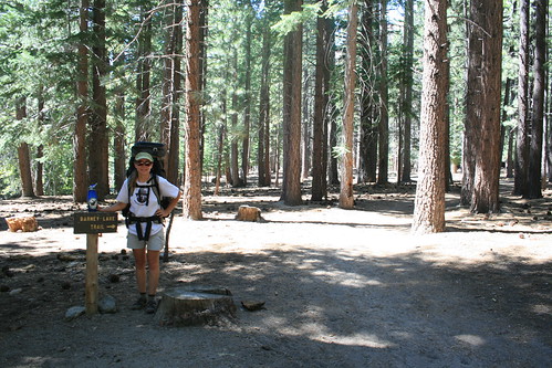
We finally made it to the end of the trail at Mono Village! We are triumphant!
I wish we could've stayed there forever, but we had to start hiking the last leg of the journey. We made it to Mono Village in less than two hours, and i was sooooo happy to see the car because of my feet. But we were also warm and all sweaty since it was getting really hot outside. So we decided to go swimming in the Twin Lakes by Mono Village, but couldn't figure out why there wasn't a beach. So we just pulled off the side of the road and took a plunge. IT WAS SOOOOO COLD! I almost had a heart attack when my body met the cold water and I was out just as soon as I jumped in. Thats why there is no beach! Needless to say, we cooled off very nicely, and felt refreshed for our long, long, long drive home. We really like the part of the hike that went through Yosemite, so I think we will be returning shortly, as soon as my tendons heel up. Get it!? LOL!

8 comments:
Amazing Pictures. Thanks for giving us this glimpse into the Hoover Wilderness!
That’s really amazing and extraordinary blogs & can help those who get issues in searching this type of information.dumpster rental near me
The vital information in this blogs has allured me.
dumpster rental near me
Your articles and contents are encouraging.
dumpster near me
I truly appreciate your working guys, thumbs up!!
experience design agency
These are truly amongst the wonderful informative blogs.
digital branding companies
UI UX design contribution to the marketing side is invaluable and practically saved the project from shutting down
design firms logo
brand development companies
The vital information in this blogs has allured me.
Post a Comment